NEWS
2016 Kumamoto Earthquake
2016/06/14
We present our deepest condolences to those who lost loved ones in the earthquakes, and also to express our sympathy to all who were affected in Kumamoto and Oita prefecture, Kyusyu. April 14, 2016 at PM 9:26 (local time), a M6.5 earthquake (JMA Seismic Intensity-Upper 6 at max) occurred in an epicenter located directly beneath the city of Kumamoto. After the quake, April 16 at AM 1:25, a M7.3 earthquake (JMA Seismic Intensity-7) occurred again. The Japan Meteorological Agency (JMA) revised the first quake was the foreshock earthquake and the second one was the main shock. Even now (April 22), there are lasting many aftershocks. Asia Air Survey implemented an emergency observation at damaged areas. The information is opened to the public through our homepage in free. We highly hope our technology is useful for constraining the second disaster and understanding the quake’s mechanism.
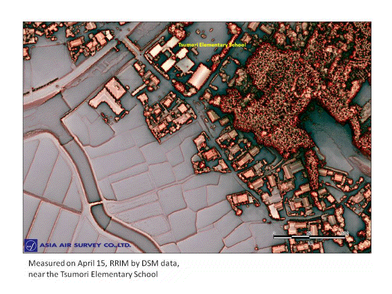
Asia Air Survey, Co., Ltd. took Airborne Lidar measurement on April 15, 2016 for confirm the seismic surface fault after the earthquake occurred on April 14.
The expected mainshock struck in the early morning of April 16, and we confirmed seismic surface fault appeared in the same area where we have taken Lidar measurement on April 15. So we decided to take another Lidar measurement on April 23, along the same courses, using same airplane and same sensors of the measurement of April 15.
→more