- HOME
- RECENT ACTIVITIES
RECENT ACTIVITIES
Participate | 7th Asia Smart City Conference
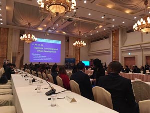
“7th Asia Smart City Conference” was held in Yokohama city, Japan from 13th to 15th November, which was hosted by Yokohama city, Asian Development Bank, and World Bank. From this year, private sector started to join this conference as “Solution Provider”. The number of participants is about 100, including 39 people from 16 countries, Japanese government, international organizations, university, and private sector.
AAS gave presentation in “Session 6: Utilizing big data/ open data for land development” about building Spatial Data Infrastructure (SDI), introducing our activity in Myanmar as well as the floating population analysis and evacuation mobility system as an example of big data utilization.
This conference was good opportunity to bridge the governmental sector with the private sector including us.
Participate | Asian Conference on Disaster Reduction 2018
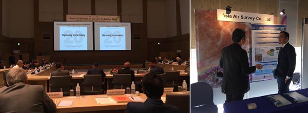
AAS participates in "Asian Conference on Disaster Reduction 2018", which is held at Awaji Island, Hyogo, Japan from 30th Oct. to 31st Oct by Asian Disaster Reduction Center. The participants of this international conference are invited from 26 countries including Japan as well as JICA, UN, universities and private sector to share their experience and activities. AAS exhibits Red Relief Image Map at the booth.
Digital Photogrammetry Training in Zimbabwe
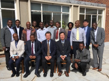
After the completion of “The Development of a Geospatial Information Database Project” (hereafter referred to as the “Harare Mapping Project”) that was funded by the Japan International Cooperation Agency (JICA) between 2015 and 2017, the Department of Surveyor General (DSG) requested Asia Air Survey (AAS) Co., Ltd for further technical assistance. In response to DSG’s requests, AAS conducted two weeks Azuka digital photogrammetry training in May 2018 at the DSG Headquarters in Harare, Zimbabwe. Azuka is a proprietary digital photogrammetry that was developed by AAS.
Growing of Volcanic Island -Nishinoshima Red Relief Image Map
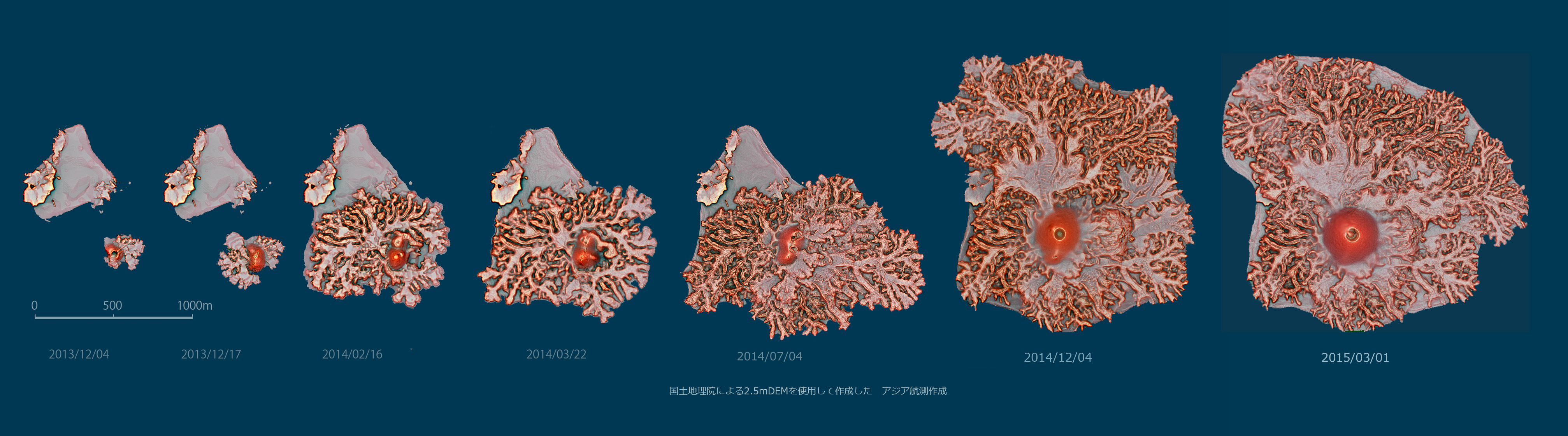
The Nishinoshima is one of volcanic island in Ogasawara Islands, re-erupted from Nov. 2013. After that, the Geospatial Information Authority of Japan has conducted 7 times aerial photogrametry for the island and already released the data to public. The Asia Air Survey has created Red Relief Image Map of the island of each period of aerial survey and beautifully expressed the process of lava flow of island.
Phase 2 monitoring of the disaster area -Great East Japan Earthquake
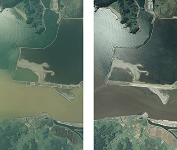
We will use aerial photography to carry out monitoring of the area affected by the Great East Japan Earthquake, and will make the information publicly available.
Photography in 2014 was carried out on July 12th,15th,26th,28th and October 8th, and all the 25 courses that were planned (531 photographs) were completed.
Aerial photography of the Mount Ontake eruption
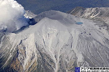
Asia Air Survey conducted aerial photographs on Sept 28 just after one day the Mount Ontake eruption.
Aerial photography of Hiroshima landslides
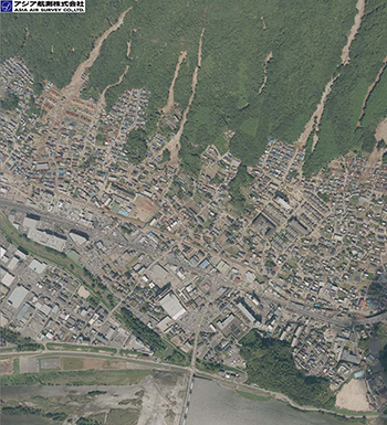
Asia Air Survey conducted aerial photographs on Aug. 21 and 30, 2014.
The Red Relief Image Map of Oso Landslide in Washington State
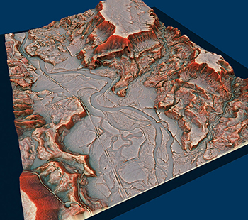
The Red Relief Image Map of Oso Landslide in Washington State. This image calculated from 2013 LiDAR survey, courtesy of the Puget Sound Lidar Consortium.
Monitoring of the disaster area - Great East Japan Earthquake
We will use aerial photography to carry out monitoring of the area affected by the Great East Japan Earthquake, and will make the information publicly available.