- HOME
- RECENT ACTIVITIES
- Phase 2 monitoring of the disaster area (July-October 2014)
Phase 2 monitoring of the disaster area (July-October 2014)
Monitoring of the disaster area -Great East Japan Earthquake
Photography in 2014 was carried out on July 12th,15th,26th,28th and October 8th, and all the 25 courses that were planned (531 photographs) were completed.
Areas photographed and purpose of monitoring
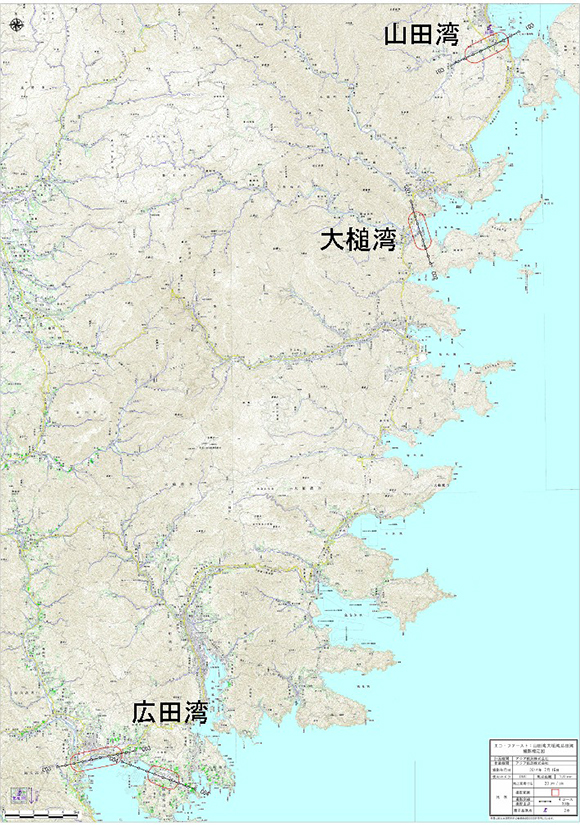
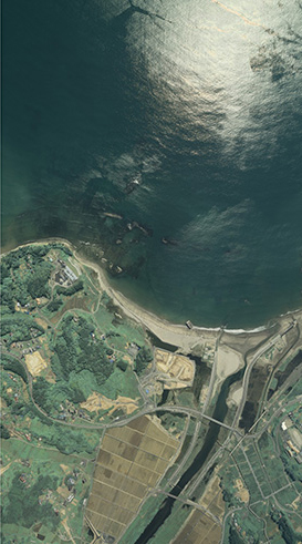
- 1.Yamada Bay
- The southern part of Yamada Town suffered extensive damage from the tsunami. Monitoring will focus on the mouth of the Orikasa River.
- Around the mouth of the Orikasa River are tidal flats and beds of eelgrass.
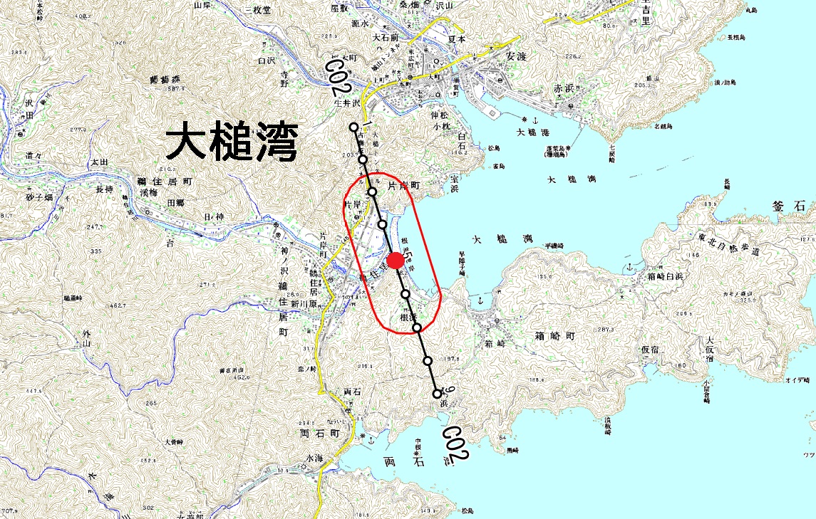
- 2.Otsuchi Bay
- The sandbars that existed around the mouth of the Unozumai River before 3.11 were well-known as a habitat for sand-dwelling insects.
- As the sandbars were destroyed by the tsunami,the process of regeneration of the sandbars will be monitored.
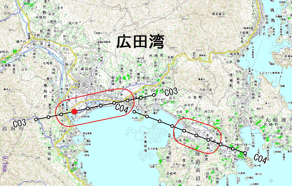
- 3.Hirota Bay
- Takata Matsubara (pine-covered area) disappeared due to the tsunami. The sequence of regeneration of the pine-covered area will be monitored.
- At Otomo-ura,tidal flats were generated by the tsunami on what had been reclaimed land. As plans are under consideration to leave these flats as an "area of natural regeneration," the situation there will be monitored.
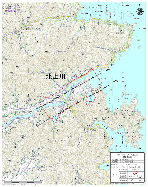
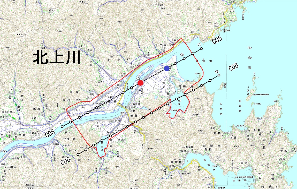
- 4.Kitakami River
- The area around the mouth of the Kitakami River formed a rich wetland environment of reed beds,river mouth sandbars and swampland,which was destroyed by the tsunami.
- Also,as there has been some formation of a new wetland environment between the Kitakami River and the Nagatsura-ura Inlet,changes in the wetland environment such as the regeneration of reed beds and river mouth sandbars will be monitored.
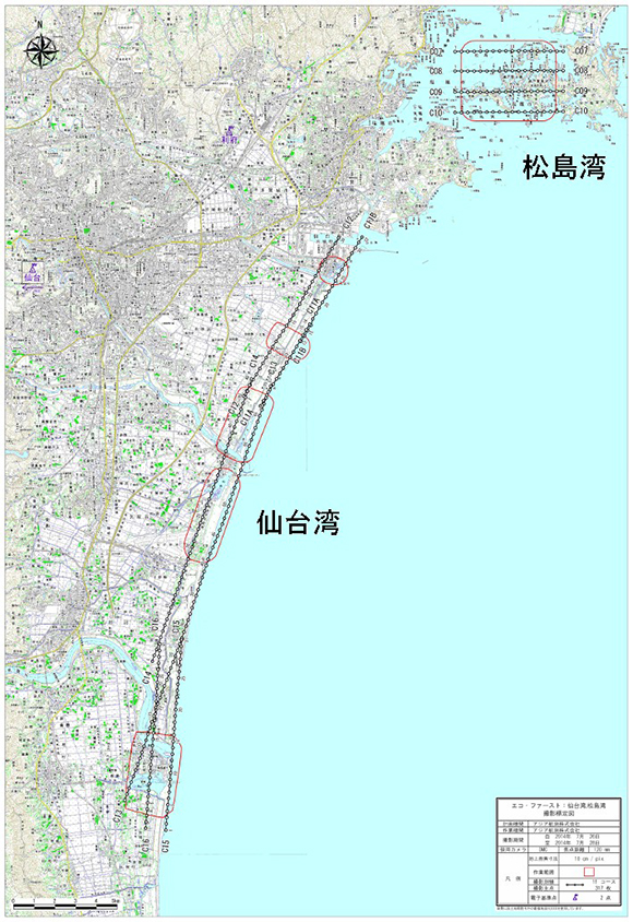
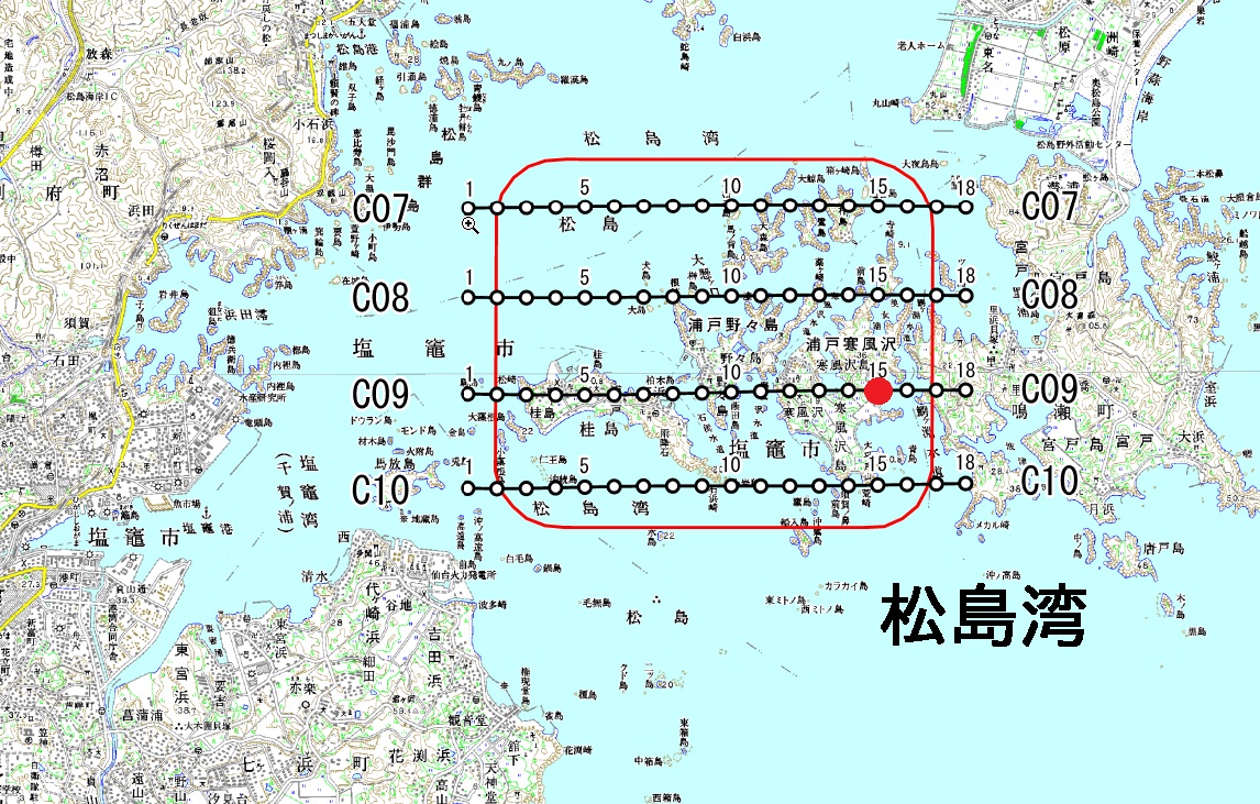
- 5.Matsushima Bay
- The islets had many small areas of reclaimed (agricultural) land,most of which were turned into tidal flats by the tsunami and land subsidence. The environments regenerated on the islets will be monitored.
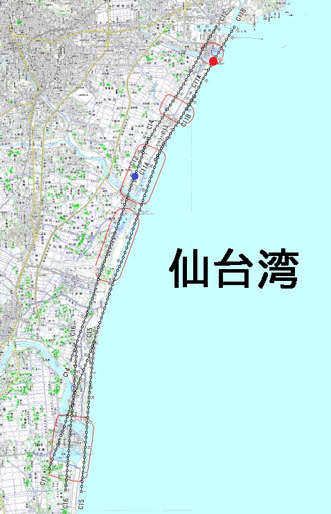
- 6.Sendai Bay
- The area including the Gamo Tidal Flat,Minami-Gamo,Ido-ura,Hiroura-Minami,the Abukuma River mouth and Lake Torinoumi.
- The Gamo Tidal Flat and Ido-ura are in a nationally-designated wildlife sanctuary,and the regeneration of the environment there will be monitored.
- The environment of the coastal area was drastically changed due to tsunami damage on the flats and land subsidence. Environmental transitions in the area that was so heavily impacted will be monitored.
- Environmental changes in the process of recovery from the disaster will be monitored.
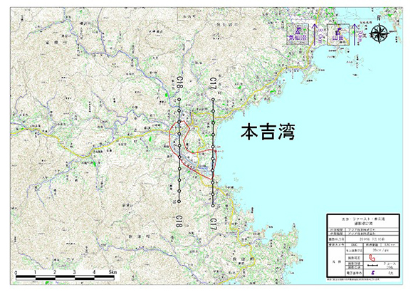
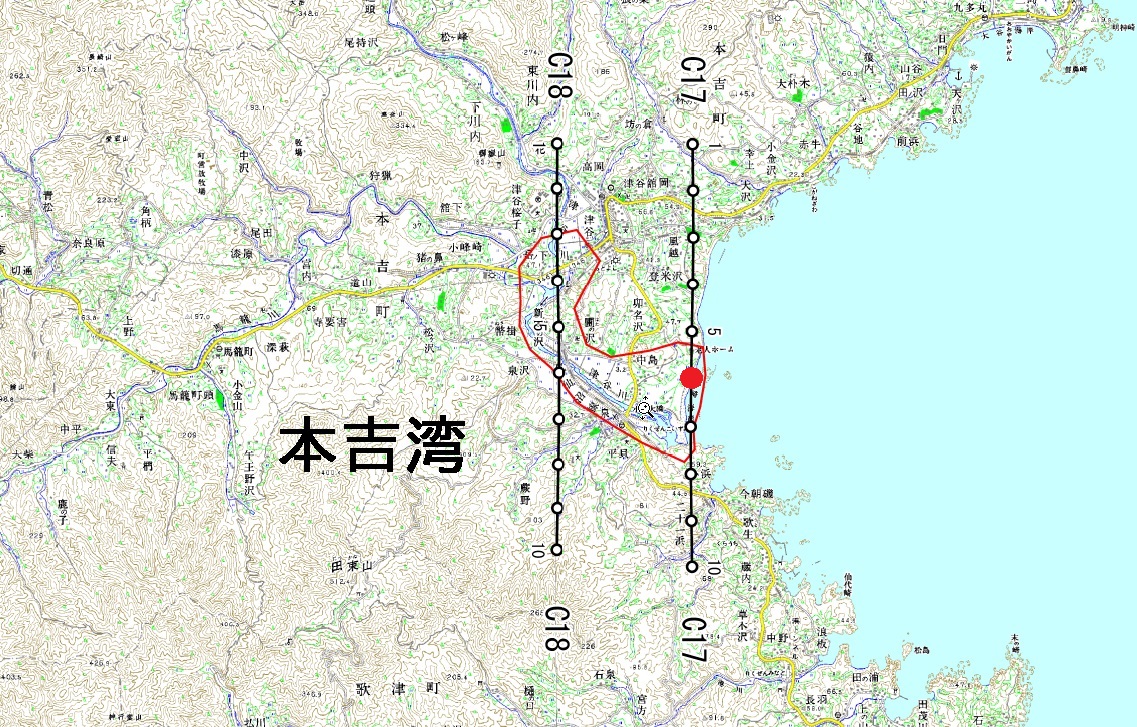
- 7.Motoyoshi Bay
- The area is one of the key areas in the Ministry of Environment "Important Nature Map". The coastal zones of Motoyoshi Bay and the lower reaches from estuary of Tsuya River, are included in this area.
- Sandy beaches and coast forest from Coastal zones of Tsuya River estuary was flowing out by the tsunami, but new sand, water, tidal flats have been formed.
- Downstream of Tsuya river of the cropland or wetlands was affected strongly by the tsunami.
- We will monitor state of the arable land of playback and the transition of environment.
- This area began to be taken from 2014.
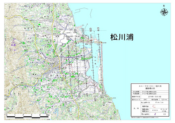
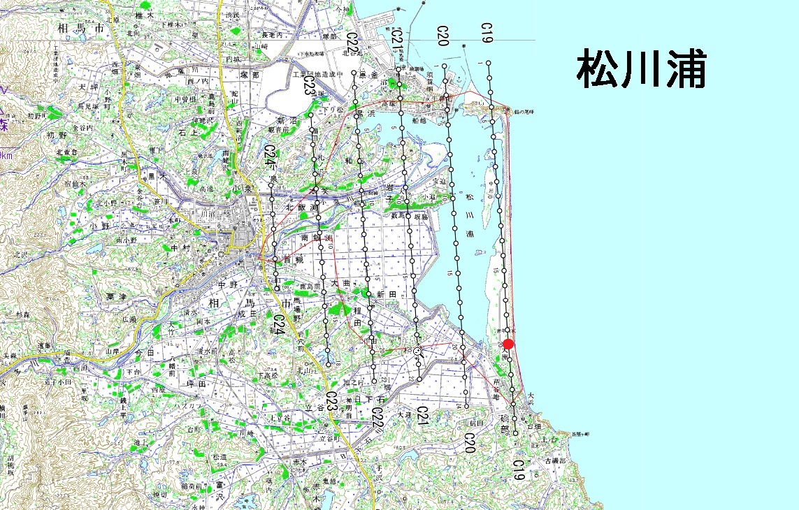
- 8.Matsukawaura
- The area is the largest tidal flats among the Sendai Bay,and is one of the key areas in the Ministry of Environment "Important Nature Map".
- We will monitor state of sandy beaches and forest trace of Ozu Coast, and the waterfront and woods of Udagawa and Koizumi River, and the wetlands of non-cropland.
- This area began to be taken from 2014.
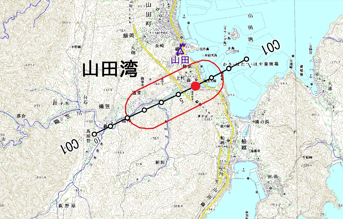
Aerial photography location diagrams
Click to expand the photography locations of the area
Photography location diagram B
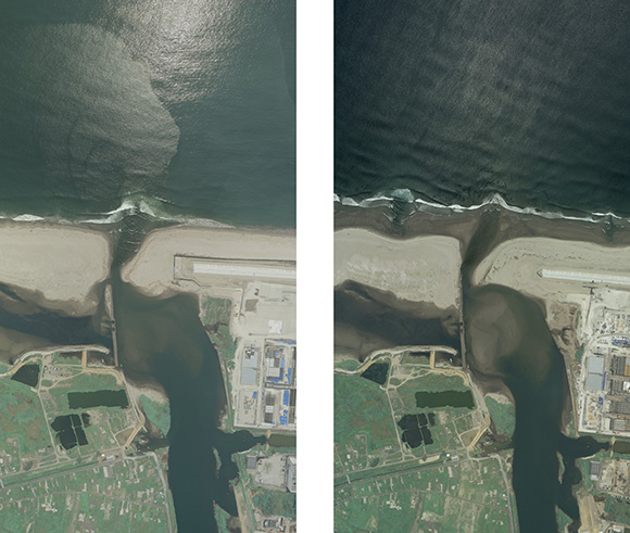
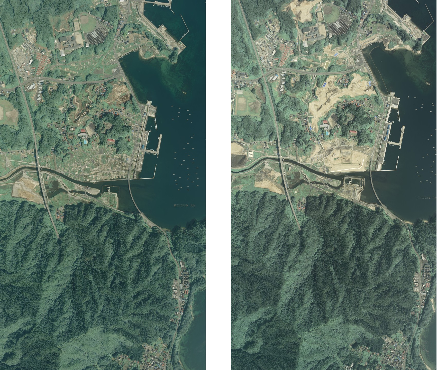
Comparison of 2013 and 2014
left:2013 / right:2014

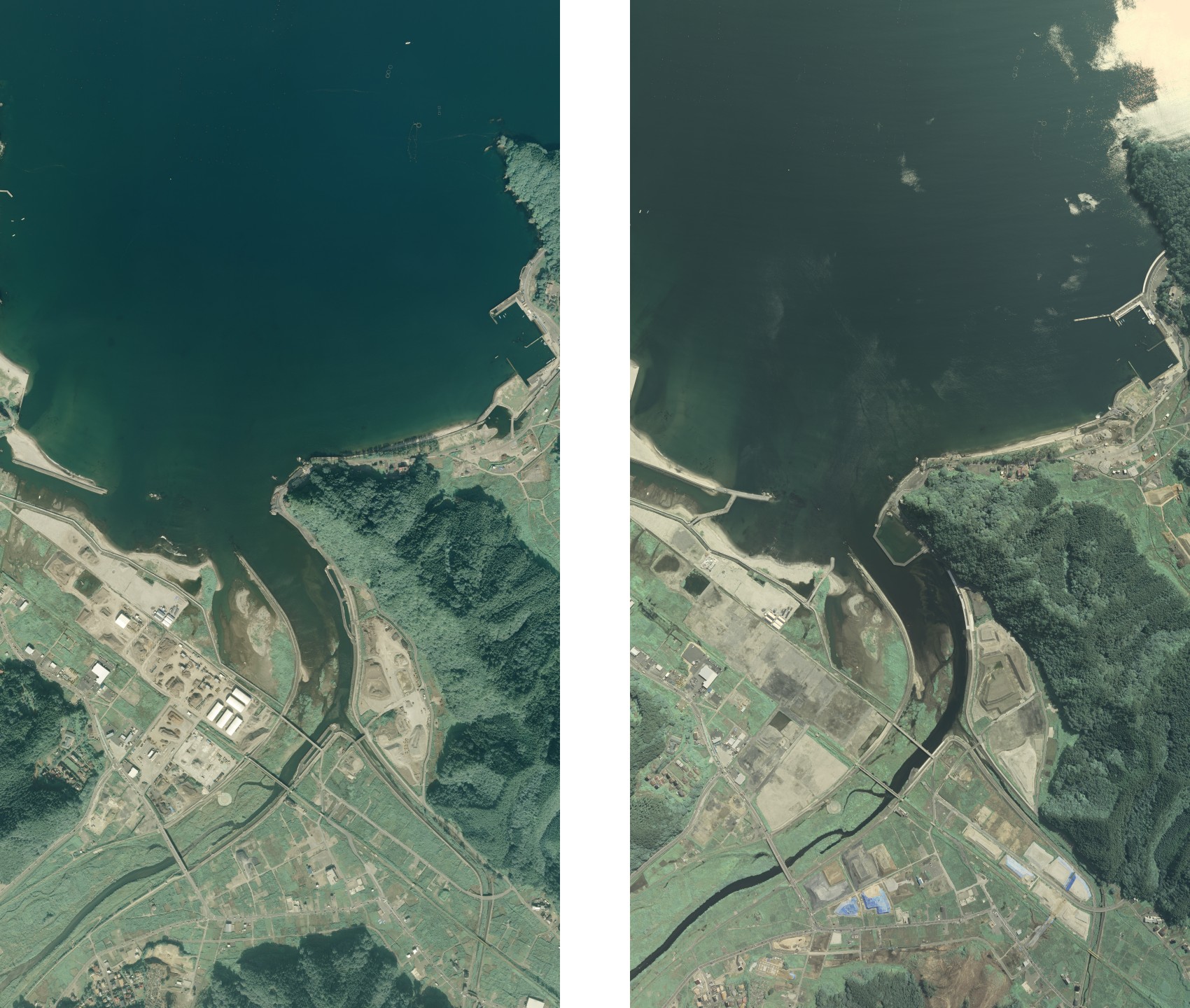
This image shows the area of (1) Yamada Bay marked in red on photography location diagram A. For other photographs, refer to the photography location diagram.
As it is assumed that the tsunami had an impact on the tidal flats and beds of eelgrass at the mouth of the Orikasa River, fixed-point observation of the impact and state of regeneration will be implemented.
(2) Otsuchi Bay
This image shows the area of (2) Otsuchi Bay marked in red on photography location diagram A. For other photographs, refer to the photography location diagram.
The sandbars at the mouth of the Unozumai River disappeared due to the tsunami. Fixed-point observation of the process of regeneration of these disappeared sandbars and the changing features of the tidal flats will be implemented.
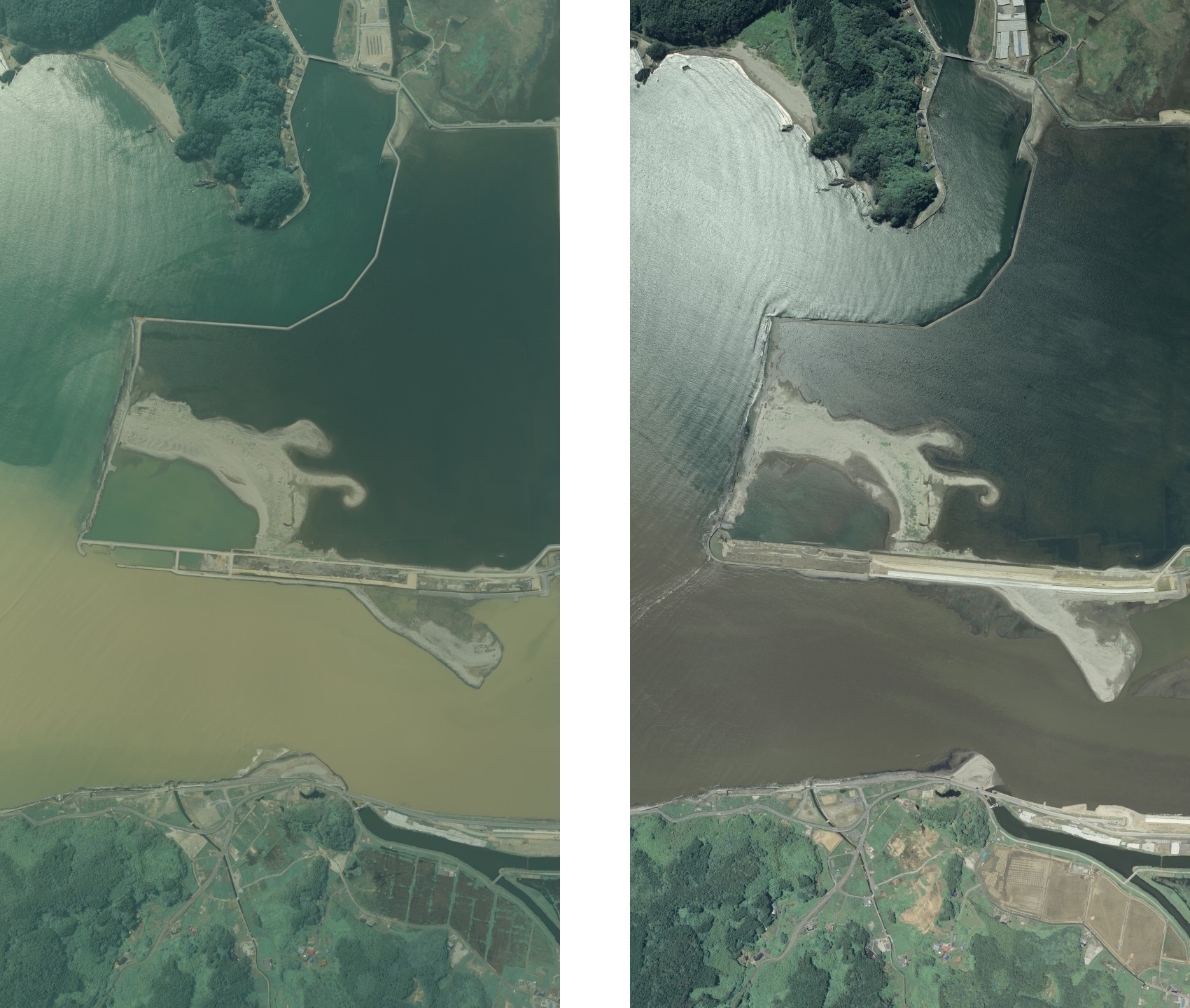
(3) Hirota Bay
This image shows the area of (3) Hirota Bay marked in red on photography location diagram A. For other photographs, refer to the photography location diagram.
With the exception of one pine tree that miraculously remained, the Takata Matsubara pine grove was washed away, and even the sand dune on which it stood disappeared. Fixed-point observation of the regeneration of this tide-water control forest, including changes in land use in the surrounding area, will be implemented.
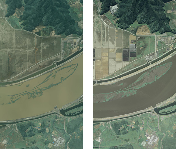
(4) Kitakami River (1)
This image shows the area of (4) Kitakami River marked in red on photography location diagram B. For other photographs, refer to the photography location diagram.
There used to be reed beds in this area at the mouth of the Kitakami River.
The reed beds disappeared due to the tsunami, and paddy fields alongside the river were inundated with sea water; but as there has been some formation of a new wetland environment, fixed-point observation of changes in the wetland environment and the state of regeneration of the reed beds will be implemented.

(4) Kitakami River (2)
This image shows the area of (4) Kitakami River marked in blue on photography location diagram B. For other photographs, refer to the photography location diagram.
There used to be reed beds in this area at the mouth of the Kitakami River.
The reed beds disappeared due to the tsunami, and paddy fields alongside the river were inundated with sea water; but as there has been some formation of a new wetland environment, fixed-point observation of changes in the wetland environment and the state of regeneration of the reed beds will be implemented.

(5) Matsushima Bay
This image shows the area of (5) Matsushima Bay marked in red on photography location diagram C. For other photographs, refer to the photography location diagram.
There used to be areas of reclaimed land along by the coast of each of the islets. Due to land subsidence these areas were covered by the sea, and in many places the regeneration of tidal flats can be observed.
Fixed-point observation of this newly-created environment and of the changes in the regenerated tidal flats will be implemented.
(6) Sendai Bay (1)
This image shows the area of (6) Sendai Bay marked in red on photography location diagram C. For other photographs, refer to the photography location diagram.
The Gamo Tidal Flat is a lagoon tidal flat at the mouth of the Nanakita River. It has been designated the Gamo Special Protection Area of the nationally-designated Sendai Coastal Wildlife Protection Area . As the tsunami that accompanied the Great East Japan Earthquake destroyed the sandbar, immediately after the disaster the area was open to the sea and lost its lagoon form, but the sandbar has since regenerated itself. Monitoring will be carried out to track the state of regeneration of the sandbar and at the same time record environmental changes in the surrounding area.

(6) Sendai Bay (2)
This image shows the area of (6) Sendai Bay marked in blue on photography location diagram C. For other photographs, refer to the photography location diagram.
Ido-ura is a lagoon at the mouth of the Natori River. It has been designated the Ido-ura Special Protection Area of the nationally-designated Sendai Coastal Wildlife Protection Area.
As in the case of the Gamo Tidal Flat, the sandbar at Ido-ura was destroyed by the tsunami.
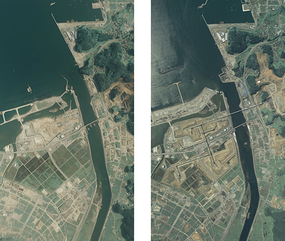
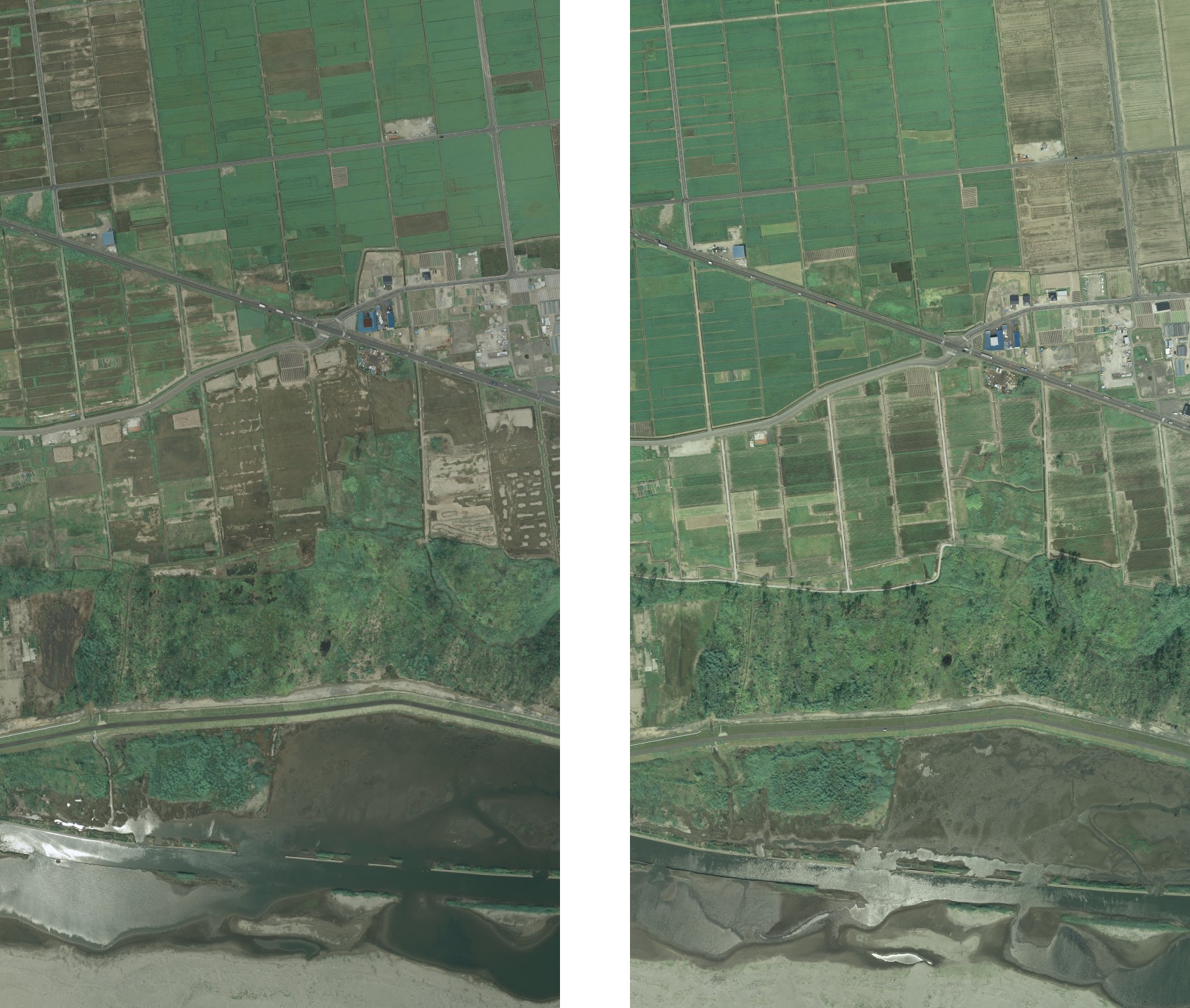
(7) Motoyoshi Bay
This image shows the area of (7) Motoyoshi Bay marked in red on photography location diagram D.
Sandy beaches and coast forest from Coastal zones of Tsuya River estuary was flowing out by the tsunami, but new sand, water, tidal flats have been formed.
Downstream of Tsuya river of the cropland or wetlands was affected strongly by the tsunami. We will record the regeneration for formed new sand, water, tidal flats in estuary of Tsuya river, as well as the transition of cultivated land and wetlands of the downstream portion.
-This area began taken from 2014.
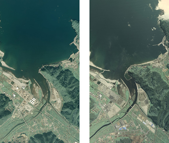
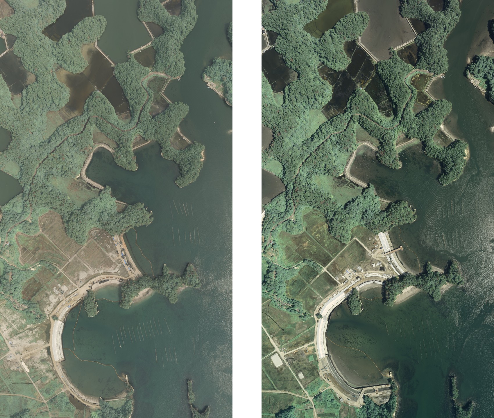
(8)Matsukawaura
This image shows the area of (8) Matsukawaura marked in red on photography location diagram E.
We will record regeneration of sandy beaches and forest trace of Ozu Coast, and the waterfront and woods of Udagawa and Koizumi River, and the wetlands of non-cropland.
-This area began taken from 2014.
Data specifications
- Method of photography:Vertical air photography taken with a 60% overlap from an altitude enabling aerial photographs to be taken with a ground pixel dimension of 10 ? 20cm.
- The reason for the use of vertical air photography is for the quantitative monitoring of successive changes.
- Period and frequency of photography: Once a year during the period from 2013 to 2020.
- Season:The season from the end of the rainy season to around September
- Type of image:Natural color, infrared color (Tiff data 8 bit)
- Image resolution: Images offered, 3840 pixels * 6912 pixels (Original image 7680 pixels * 13824 pixels)
On the use of the data
The image data is being made publicly available via intent that will be used in projects by the municipalities, cities and prefectures concerned and by the central government, as well as used for research by universities and institutes. Use in both joint and personal research is invited. With regard to use of the images, please read "Regarding Secondary Use of Disaster Area Monitoring Images" below.
July-October 2014
Updated: March 9th,2015 ver 1.00
- Update history
-
-Released September 19th, 2013
- About this page
-
On this page are posted the results of photography carried out independently by AAS.
Enquiries regarding the image data should be directed to the address given below.Contact us:
Please make your enquiry via e-mail.
E-mail: service@ajiko.co.jp
- Regarding Secondary Use of Disaster Area Monitoring Images
-
Please send in by fax, mail or e-mail your application for a license to use the photographic images.
The license will be sent to you following a review of your application.-A fee for use may be charged, depending on in what form and for what purpose the images are to be used.
-Use of the images without a license or violation of the content of the application may lead to cancellation of the license or a claim for damages.
-Images used must be clearly marked "Photograph supplied by Asia Air Survey Co., Ltd.�h -Please send to AAS some indication of the form in which the images have been used (original, copy, photograph, URL, etc.)
-Please let us know whether the results of your research can be published on the AAS website.Address for application
Disaster Photograph/Disaster Area Monitor Photograph Manager,
Head Office Management Operations Dept.,
Asia Air Survey Co., Ltd.,
Shinyuri 21 Building, 1-2-2 Manpukuji, Asao-ku, Kawasaki-shi, Kanagawa Prefecture 215-0004
FAX: +81-(0)44-965-0040 E-mail: service@ajiko.co.jp
- Copyright
-
Asia Air Survey Co., Ltd., holds the copyright to all text and images published on this page. Information obtained from this page must not be reproduced, sold, published or broadcast without permission.
- Disclaimer
-
AAS has taken every care to ensure that the information offered on this page is accurate; however we take no responsibility for the accuracy or validity of the content of the information. Please contact us if you have noticed anything that is clearly inaccurate, so that it can be corrected/deleted.
Yamada Bay
Close
Otsuchi Bay
Close
Hirota Bay
Close
Kitakami River
Close
Matsushima Bay
Close
Sendai Bay
Close
Motoyoshi Bay
Close
Matsukawaura
Close
Yamada Bay
Close
Otsuchi Bay
Close
Hirota Bay

Close
Kitakami River (1)

Close
Kitakami River (2)
Close
Matsushima Bay
Close
Sendai Bay (1)

Close
Sendai Bay (2)
Close
Motoyoshi Bay

Close
Matsukawaura

Close