History
Cutting-edge Geospatial Technology at your Service
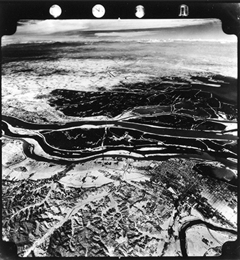
Asia Air Survey (AAS) Co., Ltd was established in 1954 as the first fully equipped private aerial survey company in Japan. AAS contributed to the re-construction of Japan using maps and survey data based on aerial photogrammetry.
1954
- Asia Aerial Survey Company (Registration of Trade Name of Company:Asia Air Survey Co., Ltd) was established on Feb. 26th, 1954, providing services in Aerial Survey, Occultation Observation and Hydrography.
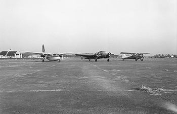
- A DEHAVILAND BEAVER was chartered, and two High Precision Plotters and an Aerial Camera were purchased.
- After the charted aircraft crashed during the Typhoon Marie in 1954, the company changed its policy, opting to own its own survey aircraft.
1956
- An Aerial Work Services License was issued by the Ministry of Transport, Japan.
1957
- The Sapporo Branch was established.
1958
- The Fukuoka Branch was established.
1959
- The Osaka Branch was established.
- The Hydrography Division became independent of Asia Air Survey, as Sanyo Hydrographic Survey Co., Ltd . (Now Sanyo Techno Marine Inc.)
- Typhoon Vera The first experience of emergency aerial photography when natural disasters occur
1960
- Successful development of the Analytical Method of Aerial Triangulation: the world's first application.
1961
- Capital reached 100 Million Yen.
1962
- The Nagoya Branch was established.
1963
- The Company name was changed to "Asia Air Survey Co.,Ltd." (Capital increased to 100.5 Million yen)
1964
- Listed on the Second Section of the Tokyo Stock Exchange Stock Code: 9233
1965
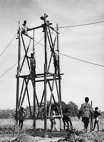
- Our First Overseas Project to provide technical support for a farmland reclamation survey, implemented in the Republic of Ghana: Ground Control Point Survey.
1967
- The Chiba Branch was established.
- The Sendai Branch was established.
1969
- The Hiroshima Branch was established.
- The Niigata Branch was established.
1970
- The Mito Branch was established.
- The Takamatsu Branch was established.
- The Morioka Branch was established.
- Buru Island (Indonesia) Overseas activities such as forest conservation become successful
1971
- The Toyama Branch was established.
- The Akita Branch was established.
- The Tokyo Branch was established.
1972
- Remote Sensing Technology was introduced.
- The Yokohama Branch was established.
- The Naha Branch was established.
- The Yamagata Branch was established.
- Successfully created the thermal images with world’s highest resolution using aircraft mounted thermal imaging devices in a partnership with Fujitsu
1973
- The Kansai Branch was established.
- The Shizuoka Branch was established.
- The Nagano Branch was established.
- The Koriyama Branch was established.
- The Kanto Branch was established.
1976
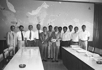
- Tendered bid for Project in Kuwait
1978
- Won bid for mapping project in Saudi Arabia
1982
- The Urawa Branch was established.
- The Analytical Plotter was introduced.
1983
- The Nagano Branch was established.
- The Tokushima Branch was established.
- The Fukushima Branch was established.
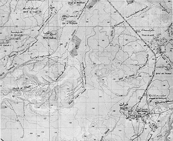
- The State of Kuwait National Map Project: Implemented Aerial Photo Survey and GCP Survey throughout the country.
- Survey throughout the country.
- Received order for the Kuwait Utility Data Management System (KUDAMS Project), conducted aerial photography survey of entire country, and began developing the world’s first authentic Geographic Information System (GIS)
1984
- 30th anniversary of establishment.
- Capital reached 1,272 million yen.
- The Yamaguchi Branch was established.
1985
- The Aomori Branch was established.
- Developed and expanded products for power utilities
1989
- The GPS Survey System was introduced.
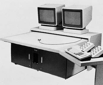
- Began developing digital plotters
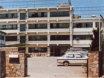
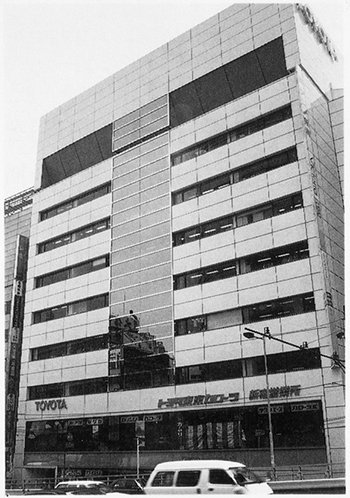
- Head Office functions were transferred Shinjuku-ku (Tokyo)
1990
- The Kuwait Project was completed.
1995
- The Great Hanshin Earthquake: an emergency aerial photography program for disaster recovery was implemented.
- The ALANDIS (Asia LAND Information System) project was launched.
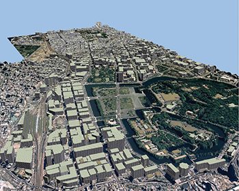
- Developed 3D city simulation system
1998
- ISO 9001 & ISO 9000 series Certification.
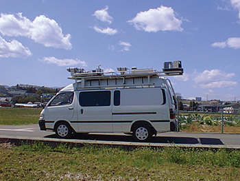
- Developed Mobile Mapping System
1999
- 50th anniversary of establishment.
2003
- Licensing services for the 3D Digital Photogrammetric Mapping Software "ZukaMeijin TM" began.
century,by Red Relief Image Map
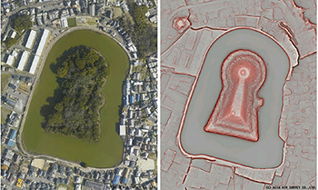
- "Red Relief Image Map" was successfully developed and patented.
2004
- ISO14001 Certification
DMC (Digital Mapping Camera) was introduced.
2005
- ISMS Certification was obtained.
2007
- The Panoramic Street Image Database "Live View" was successfully developed and patented.
2008
- Started a series of studies to develop an approach for reducing deforestation and forest degradation within the REDD implementation framework.
- Head Office functions were transferred from Shinjuku-ku (Tokyo) to Kawasaki City (Kanagawa, Shinyuri Headquarters).
2009
- Privacy Mark Standard Certification.
2010
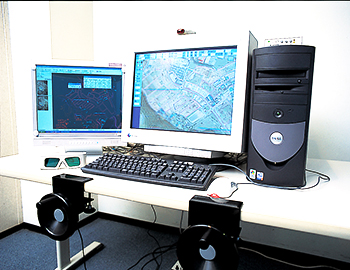
- 3D terrain viewer was launched.
2011
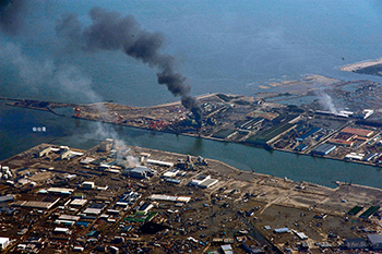
- Great East Japan Earthquake Conducted emergency photography, and make efforts for reconstruction
- Capital increase(capital 1673.77 million yen)
2012
- Received EcoFirst certification
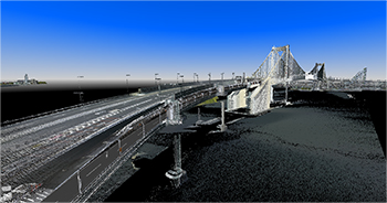
- 3D Point cloud viewer was launched
2013
- Began measurement tests for the commercialization of airborne laser bathymetry technology for rivers and coastal areas
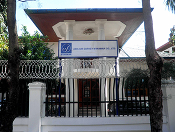
- Established “Asia Air Survey Myanmar Co., Ltd.” subsidiary in Yangon City, Republic of the Union of Myanmar
2014
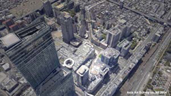
- Introduced oblique camera systems (IGI Penta DigCAM)
2015
- Entered into business agreement for spatial information technology in the railroads field with West Japan Railway Company as the largest stakeholder
2016
- Began using airborne laser bathymetry (ALB: Airborne LiDAR Bathymetry)
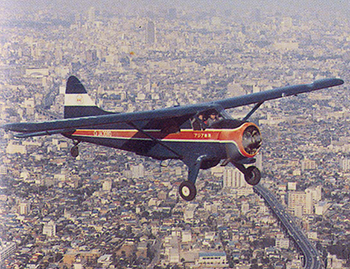
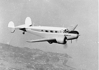
- ASIA AIR SURVEY owns and operates a fleet of 6 aircraft equipped with state-of-the-art equipment, supported by 41 branches in a nation-wide network.
- Corporate Profile
- History
- Offices