High-Precision GNSS RTK Logging Made Simple
AAS Logger enables reliable GNSS RTK surveying anywhere—from regions with well‑developed CORS networks to remote environments where only P2P communication is available.
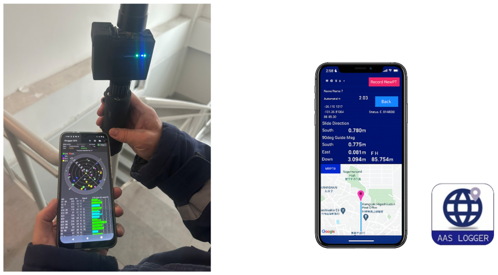
Designed to work seamlessly with Android devices and Drogger GPS, it provides a flexible and cost‑effective solution for high‑accuracy field measurement.
Intuitive Workflow Optimized for Field Operations
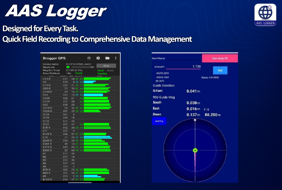
AAS Logger delivers a clean and streamlined measurement workflow:
・Clear instrument setup and coordinate system selection
・Simple point‑marking process with antenna height input and accuracy checks
・Immediate access to saved points and easy review via PT Edit
・One‑tap export to CSV for use in CAD, GIS, and analysis software
The result is fast, dependable data capture with minimal training required.
Compatible with Both P2P and Ntrip Systems
AAS Logger fully supports two operational modes:
· P2P communication for areas without CORS infrastructure
· Ntrip/VRS for regions with networked correction services
This flexibility makes the system suitable for diverse geographic and technical environments around the world.
High Measurement Accuracy You Can Trust
When paired with Drogger GPS, the system provides real‑time RTK corrections with centimeter‑level accuracy. Fix mode indicators, satellite status, and precision metrics are clearly displayed, ensuring each recorded point meets professional standards for horizontal and vertical accuracy.
Android-Based, Low-Cost, and Easy to Deploy
AAS Logger requires only:
·Two GNSS receivers (Base & Rover)
·Two Android smartphones
·Mobile internet or tethering
No special controllers or proprietary hardware are needed—ideal for budget‑conscious projects, developing countries, or rapid deployment scenarios.
Easy Data Export and PC Transfer
Point data is stored internally and exported in standard CSV format.
Files can be transferred instantly via Android’s file manager, making data integration smooth and efficient.