


Inquire for more details regarding Asia Air Survey products and services
Aiding Japan's post-war and post-disaster recovery ? Asia Air Survey
With technical services that range from the collection and analysis of aerial information to the creation of information solutions and business plans, Asia Air Survey is forging ahead to secure safe and prosperous lives for people around the world.
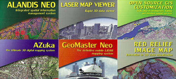
Services
CUTTING-EDGE GEOSPATIAL TECHNOLOGY AT YOUR SERVICE
Case Studies
-
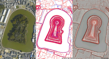
Helicopter-based LiDAR Survey
AAS in collaboration with the Archaeological Institute of Kashihara (Nara prefecture) surveyed tumulus features by Helicopter-based LiDAR.
Read more
-
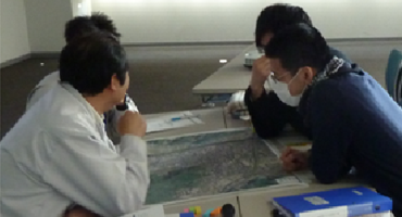
GIS Consulting Services for Local Government
AAS provides the solution to improve local governmental service and efficient GIS restructuring based on the analysis of the past GIS specifications and usage.
Read more
-
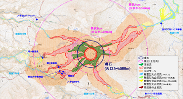
Volcanic Hazard Map of Mt. Hakkodasan
AAS took part in the hazard mapping of Mt. Hakkodasan eruption for the purpose of disaster prevention.
Read more
-
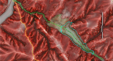
Risk management planning based on simulation of landslide dams outburst
Using Airborne LiDAR technology and landslide dam outburst simulation, AAS estimated the disaster risk areas.
Read more
-
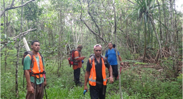
Forest Preservation under the Japanese grant aid programme
AAS implemented forest preservation projects in Malawi and Samoa as a part of Japanese grant aid programme.
Read more